![]()
Historic Maps and Plans of Inland Navigation
www.canalmaps.net
|
|
Historic Maps and Plans of Inland Navigation |
||
|
www.canalmaps.net |
|||
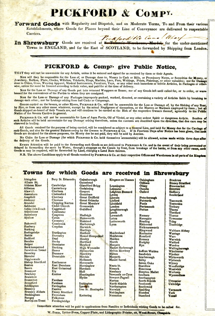
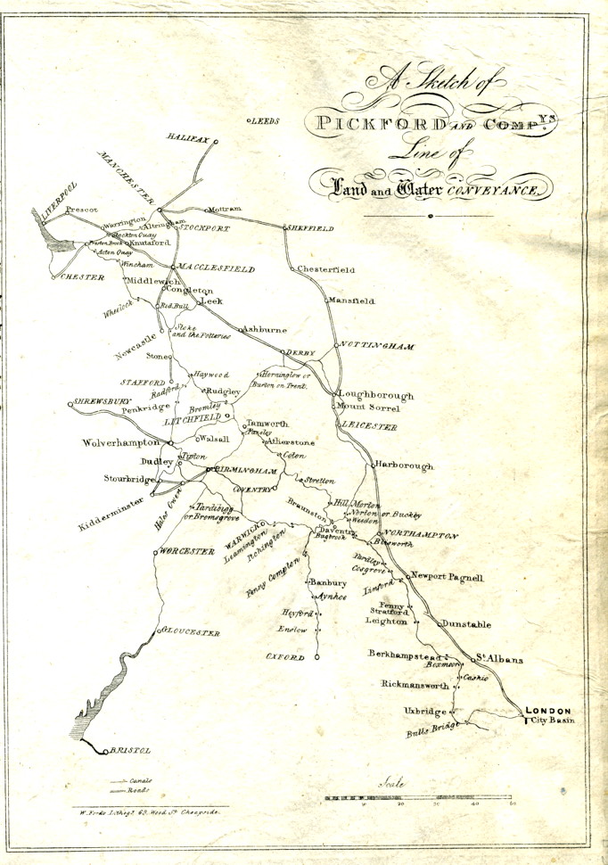
| Canalmaps ref. | B31 |
| Waterway | General |
| Title | A Sketch of Pickford and Compys. Line of Land and Water Conveyance |
| Description | Small sketch map of central England |
| Date | c1825 |
| Names | W. Fords Lithographer. |
| Scale | Approx 22 miles/inch |
| Size in inches | 7 x 11 |
| Medium/format | Lithograph on thin paper with letterpress text on left side of same sheet. |
| Source | Advertising handout. |
| Notes | Text relates to facilities in Shrewsbury, and similar examples are known for other towns. |