![]()
Historic Maps and Plans of Inland Navigation
www.canalmaps.net
|
|
Historic Maps and Plans of Inland Navigation |
||
|
www.canalmaps.net |
|||
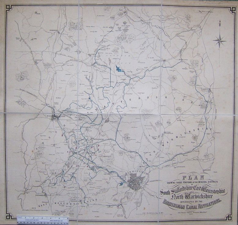
| Canalmaps ref. | A872 |
| Waterway | Birmingham Canal Navigations |
| Title | Plan shewing those portions of the mineral districts of South Staffordshire, East Worcestershire and North Warwickshire intersected by the Birmingham Canal Navigations |
| Description | General map for traders and others. |
| Date | 1873 |
| Names | John Hancox, Engineer, Navigation Office, Birmingham. |
| Scale | 1 inch/mile |
| Size in inches | 28 x 26 |
| Medium/format | Lithograph with BCN hand coloured in blue. Core area annotated with numbers in red ink, purpose unknown. Sectioned and cloth mounted to fold. |
| Source | Presentation copy from J. Hancox. |
| Notes | The final version of a map first issued in 1850, before complete re-drawing. Shows the system virtually at its fullest extent. |
Click on any part of the image for an enlarged view.
Use your browser's back button to return to this page